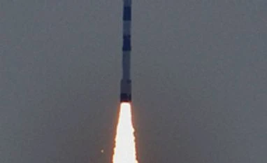
Isro's Polar Satellite Launch Vehicle (PSLV), in its twenty ninth flight (PSLV-C27), successfully blasted off successfully from the Sriharikota rocket port, Andhra Pradesh. The rocket is carrying IRNSS-1D, the fourth satellite of the Indian Regional Navigation Satellite System (IRNSS).
What is the signficance of this achievement?
Expert said, no country can afford to depend on a foreign country’s constellations for navigation during war scenarios.
IRNSS will make Indian Armed Forces self-reliant. While advanced nations like US and Russia are having GPS and GLONASS, countries like China, European Union and Japan are trying to have their own full-fledged or partial constellations.
“Our own IRNSS is important for the country’s sovereignty and strategic requirements,” said an official.
IRNSS is an independent regional navigation satellite system being developed by India. It is designed to provide accurate position information service to users in India as well as the region extending upto 1,500 km from its boundary, which is the primary service are of IRNSS. The Extended Service Area lies between primary service area.
It will provide two types of services including Standard Positioning Service (SPS), which is provided to all the users and Restricted Service (RS), which is encrypted service provided only to the authorised users. The IRNSS System is expected to provide a position accuracy of better than 20m in the primary service area.
IRNSS comprises of space and ground segments. The space segment consistes of seven satellites, with three in geostationary orbit and four in inclined geosynchronous orbit. IRNSS-1A, 1B and 1C, the first three satellites of the IRNSS constellation, have already started functioning from their designated orbital slot after extensive on-orbit test and evaluation to confirm their satisfactory performance.
IRNSS ground segment is responsible for navigation parameter generation and transmission, satellite control, ranging and integrity monitoring as well as time keeping.
What is the signficance of this achievement?
Expert said, no country can afford to depend on a foreign country’s constellations for navigation during war scenarios.
IRNSS will make Indian Armed Forces self-reliant. While advanced nations like US and Russia are having GPS and GLONASS, countries like China, European Union and Japan are trying to have their own full-fledged or partial constellations.
“Our own IRNSS is important for the country’s sovereignty and strategic requirements,” said an official.
IRNSS is an independent regional navigation satellite system being developed by India. It is designed to provide accurate position information service to users in India as well as the region extending upto 1,500 km from its boundary, which is the primary service are of IRNSS. The Extended Service Area lies between primary service area.
| IRNSS-1D Facts At a Glance |
| Launch Date: March 28, 2015 |
| Launch Vehicle: PSLV-C27 |
| Type of Satellite: Navigation |
| Manufacturer: ISRO |
| Owner: ISRO |
| Application: Navigation |
| Orbit Type: GSO |
IRNSS comprises of space and ground segments. The space segment consistes of seven satellites, with three in geostationary orbit and four in inclined geosynchronous orbit. IRNSS-1A, 1B and 1C, the first three satellites of the IRNSS constellation, have already started functioning from their designated orbital slot after extensive on-orbit test and evaluation to confirm their satisfactory performance.
IRNSS ground segment is responsible for navigation parameter generation and transmission, satellite control, ranging and integrity monitoring as well as time keeping.
)