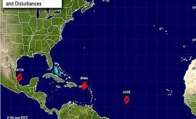
made landfall in eastern Mexico, US forecasters said, just as the country grappled with its worst earthquake in a century.
The storm had weakened to a Category One storm — the lowest on the five-level Saffir-Simpson scale — by the time it reached the state of Veracruz in the Gulf of Mexico.
At 0300 GMT, the storm was located 185 kilometers northwest of Veracruz with maximum sustained winds of 120 kilometers per hour, according to the US National Hurricane Center.
It was moving west-southwest at 11 kilometres per hour, and was projected to pour 10 to 15 inches of rain over northern Veracruz, eastern Hidalgo and Puebla.
(Only the headline and picture of this report may have been reworked by the Business Standard staff; the rest of the content is auto-generated from a syndicated feed.)
)