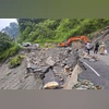
The Assam State Disaster Management Authority (ASDMA) has signed an MoU with the Geological Survey of India (GSI) for implementation of experimental regional Landslide Early Warning System (LEWS) for combating the problem of landslides in the state.
The MoU was signed by ASDMA CEO Gyanendra Dev Tripathi and Siladitya Sengupta, deputy director general, SU: Assam, GSI on Friday, an official statement said.
The problem of landslides sometimes goes unnoticed or individual landslides are being dealt with ad-hoc response mechanisms, and the problem keeps on recurring every year.
In addition to lives lost, large numbers of houses along with infrastructures destroyed in landslides in the hilly terrains of Dima Hasao, Karbi Anglong, Cachar, Karimganj and Kamrup Metropolitan districts.
During recent times, one of the major thrust areas in landslide risk reduction is the development of a regional LEWS for a large area with inputs from static landslide susceptibility and hazard maps, dynamic short and long-term rainfall forecasts, etc.
The MoU was signed between ASDMA and GSI with the objective of institutional cooperation and implementation of an experimental regional Early Warning Forecast system for making an operational model on landslides for Dima Hasao and Cachar districts, the statement said.
More From This Section
It would be extended to the entire state later, it added.
The GSI had launched Bhooskhalan' app where people, institutions, government agencies, etc, can upload incidences of landslides in their respective areas to make it more efficient in predicting and mitigating disasters as cloud sourcing.
A portal to get all the updates about landslides in India, called GSI's 'Bhusanket', is now available online as well, the statement said.
)